
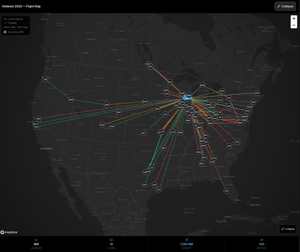
Oshkosh, Wisconsin — July 21, 2026 — EAA AirVenture is underway, and 104 PlaneWX journeys are on the map into Wittman Regional. That is not a claim that we got anyone here. Those pilots planned the trip, ran the briefing, and made the call. The map is the community looking at the same week from every coast.
A lot of those routes crossed wildfire smoke. METARs at departure and arrival can still look VFR while the corridor between them is haze. You need to see the ground and the next waypoint. As of July 15, PlaneWX samples smoke along the route so that problem shows up before you are airborne.
When NOAA’s Hazard Mapping System detects smoke near the route, a plume draws on the map. Corridor points show estimated visibility where particulate data exists. The briefing names severity, how much of the route is affected, and the lowest estimated visibility. For VFR, that visibility is scored against your personal minimums — the same soft and hard limits you already use at the airports, applied en-route. Below the hard minimum, the briefing marks a hard-limit exceedance and the breakdown names en-route smoke. Between soft and hard is a caution on the same curve, not a separate smoke scale. You need a VFR visibility hard minimum on file for smoke to produce a NO-GO. Soft-only profiles still see the overlay.
IFR flights still show the smoke. Smoke alone does not change an IFR WX Score. Instrument rules are not visibility-limited the same way.
The push to treat smoke as a first-class input came from Steve, FlightChops, PlaneWX’s YouTube partner. He walked through it in this video. A YouTube video does not make a go/no-go. The score does not either. It puts the plume on the same briefing as the rest of the weather, against the minimums you set.
Data is NOAA HMS plume outlines plus PM2.5 where we have it. Plumes are broad. They can extend past the air that is actually thick. Always look out the window, and always use the official weather you already file with.
If you are on the field this week: Mark Wolfgang is giving Advanced Aviation Risk Management tomorrow, Wednesday, July 22, 4:00–5:15 p.m. CDT, Forum Stage 10. Meetup at 11 a.m. at Flyte Booth 337. Details at planewx.ai/osh.
The in-app guide is at app.planewx.ai/help/wildfire-smoke.
About PlaneWX
PlaneWX is the pilot’s decision support system, founded in 2025 by Mark Wolfgang, a Navy veteran and commercial instrument-rated pilot. Its WX Score synthesizes authoritative weather data against each pilot’s specific aircraft and personal minimums, feeds an integrated flight risk assessment built on the FAA’s PAVE framework, and connects pilots to a peer mentor network — so go/no-go planning can start up to 14 days out, not the night before. Tagline: The confidence to go, or the courage to stay™.
Media contact
Mark Wolfgang, PlaneWX
hello@planewx.ai
www.planewx.ai