A trip rarely gets canceled because of the METAR you saw at the fuel pump. More often, the outcome was set two or three days earlier, when the forecast first hinted at lower ceilings, stronger winds, or convective timing that did not fit the mission. That is where pilot decision making weather really starts — not at engine start, but when you begin shaping expectations around risk.
For most GA pilots, the hardest weather calls are not the obvious no-go days. They are the marginal days that can still work if timing, route, altitude, and alternates all line up. Those are the flights that test judgment. You are not asking whether weather exists. You are asking whether this specific mission, in this aircraft, with this pilot, remains inside acceptable margins.
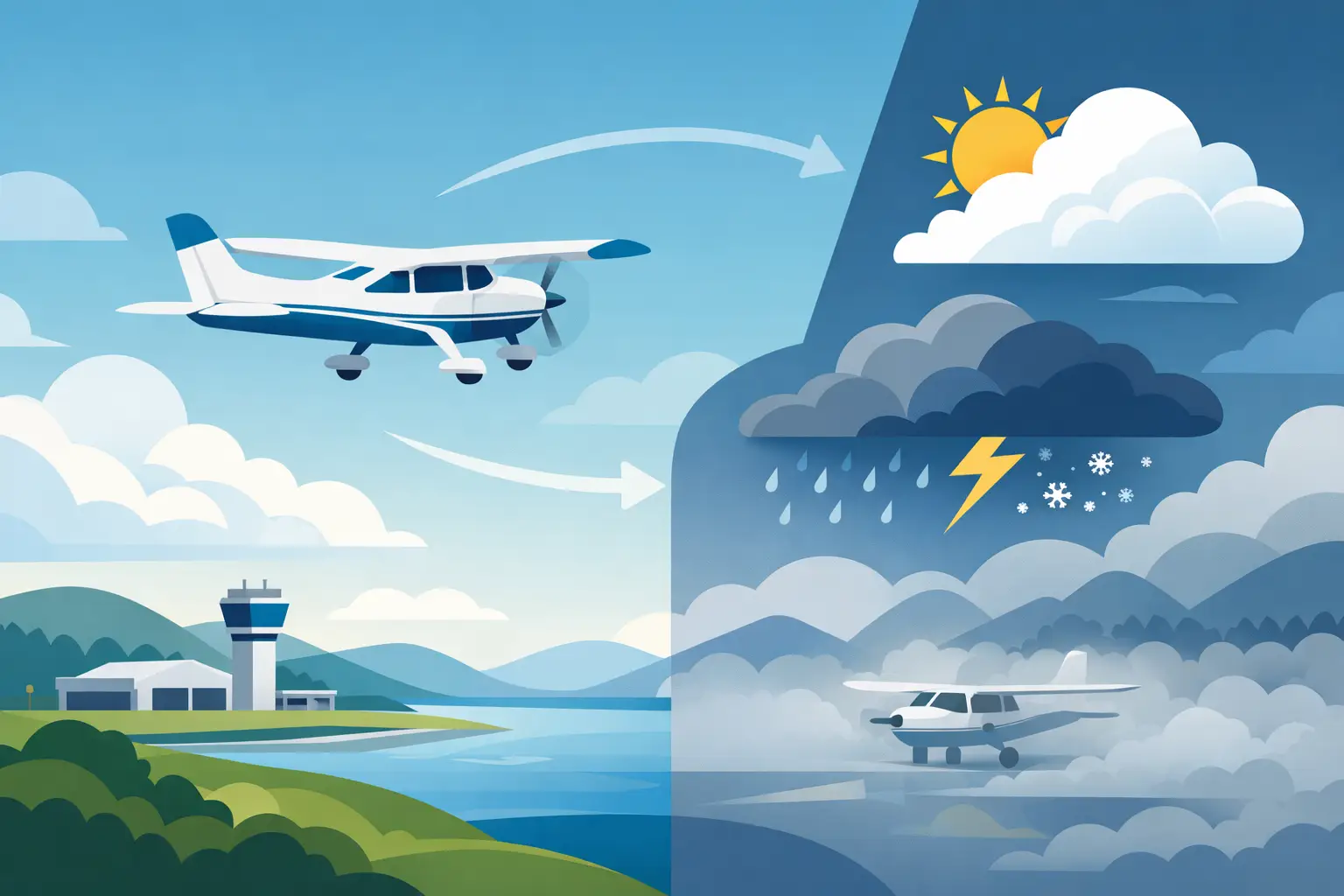
Why pilot decision making weather starts early
Weather decisions improve when they are made in layers. Five days out, you are not looking for precision. You are looking for pattern recognition. Is the route trending toward widespread IFR, afternoon convection, strong surface winds, mountain obscuration, or a frontal passage that narrows your options? At that stage, the value is not in a perfect answer. The value is in reducing surprise.
Pilots get into trouble when they expect day-of-flight tools to solve a planning problem that started much earlier. TAFs, METARs, PIREPs, and radar are essential near departure, but they are not built to carry the whole decision load several days in advance. If your mission matters — family trip, owner flight, business meeting, maintenance reposition — you need an earlier picture of weather risk so you can decide whether to protect the schedule, move the departure window, or stand down before the plan hardens.
That early view also helps with human factors. Once passengers are lined up, hotel bookings are made, and the airplane is fueled, the pressure profile changes. Good judgment is easier when you have already said, "This flight only works if ceilings improve by 1500Z," or "If the crosswind trend holds above my limit, we are driving." Early weather planning gives you room to be disciplined later.
A practical framework for pilot decision making weather
The cleanest way to think about weather is to combine mission risk with forecast confidence. A marginal forecast with high confidence may be easier to manage than a decent forecast with high uncertainty. What matters is not just what the weather might be, but how likely it is to break your personal and operational limits.
Start with the mission itself. A short local flight with multiple paved alternates is different from a four-state cross-country into a single-runway destination with rising terrain and a narrow arrival window. Then look at the pilot-aircraft combination. A current instrument pilot in a well-equipped aircraft has more available options than a VFR-only pilot in a lighter airplane sensitive to wind and icing. That sounds basic, but many poor decisions happen when pilots assess the weather in isolation instead of in context.
This is where the FAA's PAVE framework still earns its place. The weather may be workable from an aircraft standpoint but not from a pilot proficiency standpoint. Or it may be legal from a pilot standpoint but poor from an external-pressure standpoint because the mission has no timing flexibility. Weather is rarely the only variable, but it is often the one that exposes weakness in the others. PlaneWX pre-fills the Environment quadrant of the PAVE Risk Assessment automatically — so when you sit down to evaluate the full picture, the weather analysis is already there.
What to watch 3 to 7 days out
Several days before departure, broad pattern signals matter more than airport-specific detail. If the ECMWF and other guidance are aligned on a slow-moving system crossing your route, that is useful. If the guidance is split on timing by 12 hours, that is useful too, because uncertainty is itself an operational input.
At this horizon, ask a few disciplined questions. Is the weather risk localized or widespread? Is it primarily a timing problem, a route problem, or a destination problem? Does the pattern suggest improving or deteriorating conditions through the planned departure and return windows? Can a one-day shift materially improve the odds?
For GA planning, the biggest traps at this stage are freezing the first plan and over-reading specifics. A forecast thunderstorm line four days out is not a route amendment yet. But a repeated signal for convection across the Southeast on summer afternoons should absolutely affect your departure strategy. The same goes for winter icing setups, spring wind events, or marine layers that may not burn off on your preferred schedule.
PlaneWX does exactly this — scoring your specific mission against YOUR personal minimums and YOUR aircraft using HRRR, GFS, and ECMWF consensus to produce a WX Score up to 14 days out. Rather than leaving you to mentally combine ceilings, winds, precipitation, instability, and timing across multiple forecast sources, you get a single number that answers the real question early: is this trip trending toward viable, marginal, or stand-down territory? That does not replace your EFB workflow. It sharpens the question earlier, when you still have options.
The day before: narrow the decision
Once you get into the 12- to 24-hour window, the work changes. Now you can begin testing the route against specific constraints. Compare TAF trends along the route and at realistic alternates. Check whether the surface picture supports what the upper-air setup suggested earlier. Review G-AIRMETs with some skepticism but not dismissal — they are broad by design, yet they often capture the environment that matters to GA pilots.
This is also the right time to challenge your own optimism. If the route only works with a one-hour gap between lowering ceilings and destination arrival, that is not much margin. If the airport needs a crosswind component near your limit and the forecast has been consistently increasing, assume the burden is on the plan, not on your ability to "make it work."
For IFR pilots, one of the most useful habits is separating legal from prudent. Alternate fuel may make the dispatch math work, but if the regional weather picture suggests multiple airports could degrade together, your practical options may be thinner than the filing allows. For VFR pilots, the same logic applies to scud-running temptation on days when ceilings are technically above pattern altitude but the route is narrowing.
Day-of-flight weather decisions are about confirmation, not hope
By the morning of departure, pilot decision making weather should be focused on confirmation. METARs, radar, PIREPs, winds aloft, and short-range guidance like HRRR are excellent tools for validating or rejecting the plan you built earlier. They are not there to rescue a mission that has been weather-fragile for three days.
This matters because weather-related decision errors often come from late-stage reinterpretation. A pilot sees one favorable PIREP and discounts the broader trend. Or a temporary improvement in one METAR gets treated as a durable pattern change. That is how a cautious plan turns into rationalization.
A better approach is to define trigger points in advance. If the destination ceiling is still below X by a certain time, you delay. If convective initiation is advancing faster than forecast, you depart earlier only if the full route and return logic still hold. If the crosswind is already near your limit before peak mixing, you stop there. Pre-committed triggers reduce the temptation to negotiate with weather in real time.
Quantifying uncertainty beats guessing at it
Most pilots are comfortable reading weather products. Fewer are comfortable weighting uncertainty. That is the gap that matters most in longer-range planning. A forecast that says 2,500 broken, 5 miles, and light rain at your ETA is useful. But what you really want to know is how likely that outcome is, what the downside spread looks like, and whether the pattern tends to miss better or worse.
Quantified risk does not make the decision for you, but it gives structure to the judgment call. That is why probability-based planning is so valuable for cross-country GA. Your WX Score will never replace pilot judgment, aircraft capability, or a proper preflight weather review. It does something more practical: it helps you stop treating all marginal forecasts as equal. Some are marginal but stable. Others are marginal and deteriorating. Those are very different flights.
The strongest weather decision makers are not the ones who can recite the most products. They are the ones who recognize when confidence is low, margins are shrinking, and the mission no longer deserves the benefit of the doubt. If you want better calls, start earlier, frame the mission honestly, and treat uncertainty as part of the weather — not as a footnote.
The goal is not to fly less. It is to make fewer weather decisions from a corner. I built PlaneWX because I was tired of telling my wife "I'll let you know after the TAF comes out tonight." That is a terrible time to make a consequential decision. Give yourself the early picture — and with it, the confidence to go, or the courage to stay.
Start your free PlaneWX briefing →
— Mark Wolfgang, Commercial Instrument pilot, Cirrus SR22T, and founder of PlaneWX